

Impact Factor:4.848
DOI number:10.3390/rs8080652
Journal:Remote Sensing
Key Words:Coastal subsidence; Land Reclamation; PT-based SBAS-InSAR; Sea Level Rise; Shenzhen
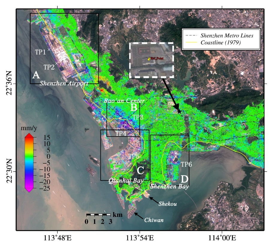
Abstract:Shenzhen, the first special economic zone of China, has witnessed earth-shaking changes since the late 1980s. In the past 35 years, about 80 km(2) of land has been reclaimed from the sea in Shenzhen. In order to investigate coastal vertical land motions associated with land reclamation, we proposed an elaborated Point Target (PT) based Small Baseline Subset InSAR (SBAS-InSAR) strategy to process an ENVISAT ASAR ascending and descending orbits dataset both acquired from 2007 to 2010. This new strategy can not only select high density PTs but also generate a reliable InSAR measurement with full spatial resolution. The inter-comparison between InSAR-derived deformation velocities from different orbits shows a good self-consistency of the results extracted by the elaborated PT-based SBAS-InSAR strategy. The InSAR measurements show that the reclaimed land is undergoing remarkable coastal subsidence (up to 25 mm/year), especially at the Shenzhen Airport, Bao'an Center, Qianhai Bay and Shenzhen Bay. By analyzing the results together with land reclamation evolution, we conclude that the ground deformation is expected to continue in the near future, which will amplify the regional sea level rise.
Indexed by:Journal paper
Document Code:652
Discipline:Engineering
First-Level Discipline:Surveying and Mapping
Document Type:J
Volume:8
Issue:8
Translation or Not:no
Included Journals:SCI
Links to published journals:https://www.mdpi.com/2072-4292/8/8/652