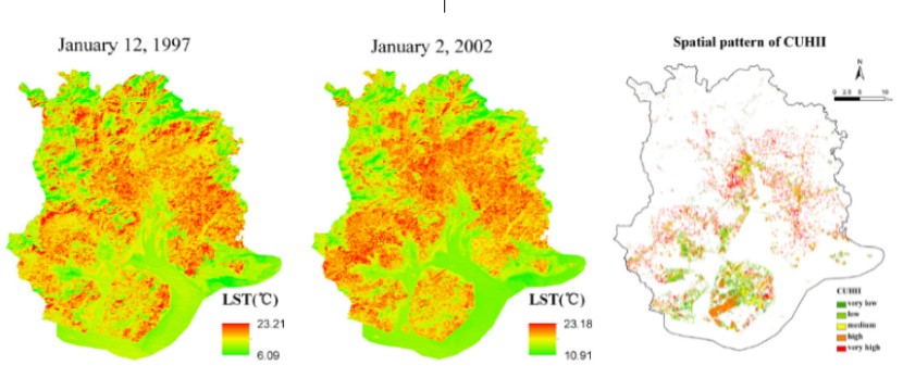
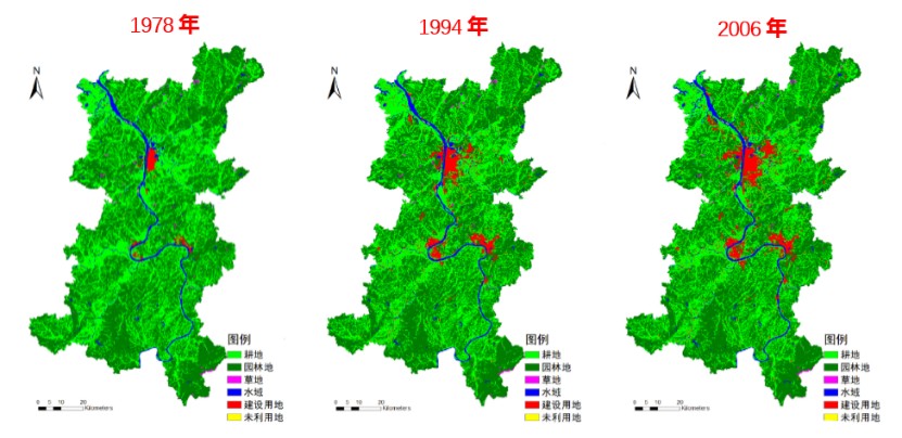
§ 研究领域一:城市扩张监测模拟与生态效应评估
运用多源遥感数据,开展典型地区土地利用及城市扩张模式研究,分析其驱动因子的区域差异性;构建土地利用变化模型,预测不同人工干预条件下未来变化趋势,为土地利用规划与城市发展策略提供科学的辅助依据;结合土地利用变化及城市扩张的监测结果,进一步研究人类活动下大气污染、城市热岛、农业干旱等生态环境的响应特征,并定量区分了土地利用变化的贡献率,为相关决策规划提供科学的辅助依据。代表性成果如下:
[01] 城市空间扩张遥感监测与智能规划关键技术创新及应用, 湖南省科技进步二等奖, 湖南省科技厅, 2020.
[02] 地理国情视角下的城市病监测技术与实践, 全国测绘科技进步二等奖, 中国测绘地理信息学会, 2017.
[03] 国家级重要地理国情监测与分析关键技术和应用, 全国地理信息科技进步特等奖, 中国地理信息产业协会, 2017.
[04] 邹滨, 邹峥嵘, 陶超, 汤玉奇, 翟亮. 《城市地理国情监测》[M]. 北京:科学出版社, 2021. ISBN: 978-7-03-063160-2. 专著(主编).
[05] Liu Xiangping, Zou Bin*, Feng Huihui, et al. Anthropogenic factors of PM2.5 distributions in China's major urban agglomerations: A spatial-temporal analysis[J]. Journal of Cleaner Production, 2020, 264:121709.
[06] Xu Shan, Zou Bin*, Sedra Shafi, et al. A hybrid Grey-Markov/ LUR model for PM10 concentration prediction under future urban scenarios[J]. Atmospheric Environment, 2018,187:401-409.
[07] Feng Huihui, Zou Bin*, Tang Yumeng. Scale- and region-dependence in landscape-PM2.5 correlation: implications for urban planning[J]. Remote Sensing, 2017, 9(9):918.
[08] Xiong Ying, Peng Fen, Zou Bin*, et al. Spatiotemporal influences of land use/cover changes on the heat island effect in rapid urbanization area[J]. Frontiers of Earth Science, 2019, 13(3):614-627.
[09] Zou Bin*, Xu Shan, Troy Sternberg, et al. Effect of land use and cover change on air quality in urban sprawl [J]. Sustainability, 2016, 8(7):677.
[10] Wong Mansing, Peng Fen, Zou Bin*, et al. Spatially analyzing the inequity of the Hong Kong urban heat island by socio-demographic characteristics[J]. International Journal of Environmental Research and Public Health, 2016, 13(3):317.
§ 研究领域二:时空多尺度大气遥感监测与制图
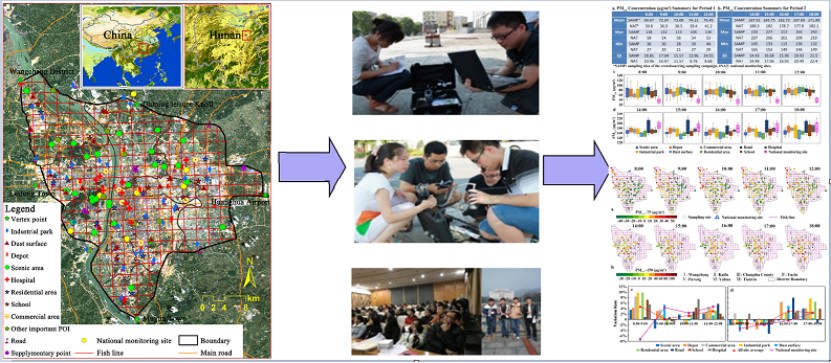
针对空气质量稀疏监测点观测数据在精细空间尺度反映空气污染特征的空间局限性,采取基于卫星监测的遥感反演、开展了城市微环境大气颗粒物浓度高密观测试验、通过建立离散观测数据和影响因素数据的经验统计关系建模手段模拟浓度空间分布的思路加以克服,取得了一系列研究成果。代表性成果如下:
[01] Liu Ning, Zou Bin*, Li Shenxin, et al. Prediction of PM2.5 concentrations at unsampled points using multiscale geographically and temporally weighted regression[J]. Environmental Pollution, 2021,284:117116.
[02] Xu Shan, Zou Bin*, Sedra Shafi, et al. A hybrid Grey-Markov/ LUR model for PM10 concentration prediction under future urban scenarios[J]. Atmospheric Environment, 2018,187:401-409.
[03] Xu Shan, Zou Bin*, Lin Yan, et al. Strategies of method selection for fine-scale PM2.5 mapping in an intra-urban area using crowdsourced monitoring[J]. Atmospheric Measurement Techniques, 2019, 12(5):2933-2948.
[04] Li Shenxin, Zou Bin*, Fang Xin, et al. Time series modeling of PM2.5 concentrations with residual variance constraint in eastern mainland China during 2013-2017[J]. Science Of The Total Environment, 2020,710:135755.
[05] Fang Xin, Zou Bin*, Liu Xiaoping, et al. Satellite-based ground PM2.5 estimation using timely structure adaptive modeling[J]. Remote Sensing of Environment, 2016, 186:152-163.
[06] Zou Bin*, Pu Qiang, Muhammad Bilal, et al. High–resolution satellite mapping of fine particulates based on geographically weighted regression[J]. IEEE Geoscience and Remote Sensing Letters, 2016, 13(4):495-499.
[07] Zou Bin*, Chen, J, Zhai, L., et al. Satellite based mapping of ground PM2.5 concentration using generalized additive modeling[J]. Remote Sensing, 2017, 9(1),1.
[08] 许珊, 邹滨*, 胡晨霞. 面向场景的城市PM2.5浓度空间分布精细模拟[J]. 中国环境科学, 2019,39(11):4570-4579.
[09] 游介文, 邹滨*, 赵秀阁, 许珊, 何瑞. 基于随机森林模型的中国近地面NO2浓度估算[J]. 中国环境科学, 2019,39(03):969-979.
[10] 方新, 邹滨*, 刘宁. 不确定性约束下的AOD空间覆盖STRE建模优化[J]. 武汉大学学报(信息科学版), 2020,45(04):534-541.
§ 研究领域三:土壤重金属高光谱遥感探测与待修复空间规划
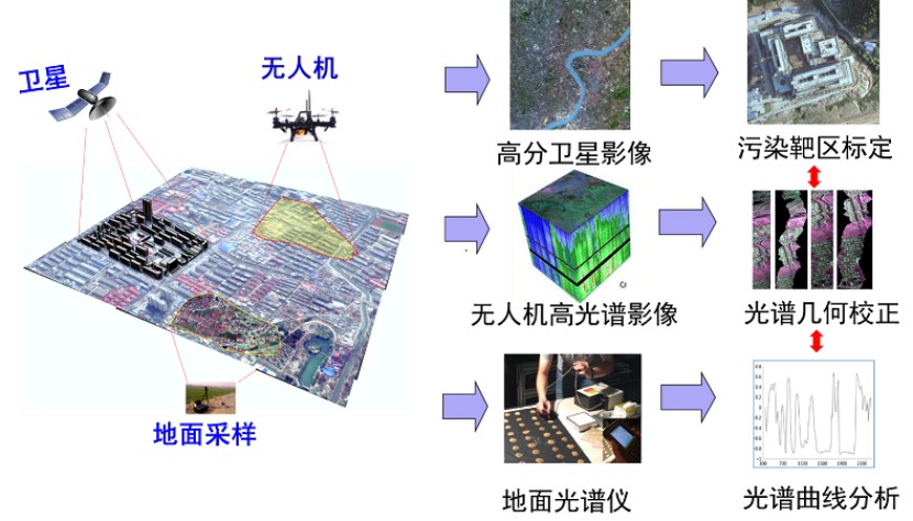
针对传统野外土壤重金属采样测试方法难度大,成本高,效率低的问题,集成航空、航天与地面多源遥感数据开展土壤重金属污染高光谱遥感空天地一体化探测;引入了类标准化样品制备方法,构建重金属含量的土壤高光谱反演模型,探索土壤光谱与重金属污染物含量间的响应规律;同时,提出一种集成健康风险评估与地理探测方法的土壤重金属污染空间修复区识别的方案,为土壤重金属污染快速、准确、大范围探测及其待修复空间规划提供了新的契机。代表性成果如下:
[01] 教育部奖励:作为成员入选全国高校黄大年式教师团队, 2017.
[02] 湖南省科技创新奖:湘江流域重金属污染防治技术研发与应用, 2017.
[03] Tu Yulong, Zou Bin*, Feng Huihui, et al. A near standard Soil Samples Spectra Enhanced Modeling Strategy for Cd Concentration Prediction[J]. Remote Sensing, 2021, 13(14):2657.
[04] Zou Bin, Jiang Xiaolu*, Feng Huihui*, et al. Multisource spectral-integrated estimation of cadmium concentrations in soil using a direct standardization and Spiking algorithm.Science Of The Total Environment[J]. The Science of the Total Environment, 2020, 701:134890.
[05] Zhou Mo, Zou Bin*, Tu Yulong, et al. Hyperspectral Modeling of Pb Content in Mining Area Based on Spectral Feature Band Extracted from Near Standard Soil Samples[J]. Spectroscopy and Spectral Analysis. 2020,40 (7):2182-2187.
[06] Jiang Xiaolu, Zou Bin*, Feng Huihui, et al. Spatial distribution mapping of Hg contamination in subclass agricultural soils using GIS enhanced multiple linear regression[J]. Journal of Geochemical Exploration, 2019,196:1-7.
[07] Jiang Xiaolu, Zou Bin*, Tu Yulong, et al. Quantitative Estimation of Cd Concentrations of Type Standard Soil Samples Using Hyperspectral Data[J]. Spectroscopy and Spectral Analysis, 2018,38(10):3254-3260.
[08] 基于室内标样高光谱特征的土壤重金属Cd含量反演建模及其光谱响应特征波段识别方法, 国家发明专利(201710120751.0, 已授权).
[09] 一种联合土壤室内外光谱的重金属含量反演方法, 国家发明专利(201810233070.X, 已授权).
[10] 土壤重金属污染风险评估系统, 计算机软件著作权(2012SR108000).
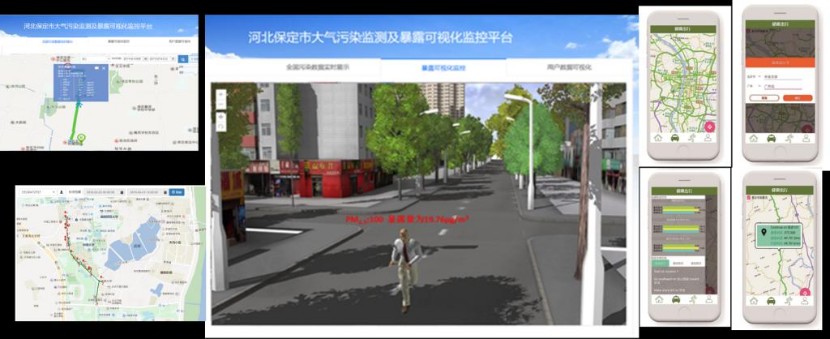
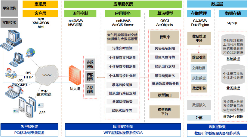
§ 研究领域四:环境污染暴露时空精细测量与大数据预警平台
在聚焦于面向地理空间场景提供实时污染信息和提醒服务的基础上,通过将大气/土壤/水体污染与人体的暴露参数以及暴露健康效应结合起来,以人为中心针对不同人群、个体开展精确的气/水/土暴露时空精细测量以及基于人群活动大数据提供风险预警服务。代表性成果如下:
[01] 邹滨, 湛飞并, 曾永年. 2012.12. 《空气污染暴露时空建模与风险评估》. 北京:中国环境科学出版社. ISBN: 978-7-5111-1106-7. 专著.
[02] 邹滨, 湛飞并, 2016. 空气污染暴露评估与环境健康风险分析(第六章), & 地理空间分析在中国公共健康研究中的应用:进展与展望(第十三章),《地理信息科学 在公共卫生与健康中的应用》,北京:高等教育出版社,2016. ISBN: 978-7-04-044052-2. 编著.
[03] Zou Bin*, Wilson J. Gaines, Zhan F. Benjamin, et al. Air pollution exposure assessment methods utilized in epidemiological studies[J]. Journal of Environmental Monitoring, 2009, 11(3):475-490.
[04] Zou Bin, Wilson J. Gaines, Zhan F. Benjamin, et al. An emission-weighted proximity model for air pollution exposure assessment [J]. Science of the Total Environment, 2009, 407(17):4939-4945.
[05] Zou Bin, Li Shenxin, Zheng Zhong, et al. Healthier routes planning: A new method and online implementation for minimizing air pollution exposure risk[J]. Computers Environment and Urban Systems, 2020, 80:101456
[06] Zou Bin*, Li Shenxin , Lin Yan, et al. Efforts in reducing air pollution exposure risk in China: State versus individuals[J]. Environment International,2020,137:105504.
[07] Zou Bin*, Zheng Zhong, Wan Neng, et al. An optimized spatial proximity model for fine particulate matter air pollution exposure assessment in areas of sparse monitoring[J]. International Journal of Geographical Information Science, 2016, 30(4):727-747.
[08] Zou Bin*, You Jiewen, Lin Yan, et al. Air pollution intervention and life-saving effect in China[J]. Environment International, 2019, 125:529-541.
[09] 一种基于低空气暴露风险道路路径选择方法, 国家发明专利(ZL20141047513.5, 已授权).
[10] 暴露风险可视化监控平台, 计算机软件著作权(2018SR218303).
