个人简介
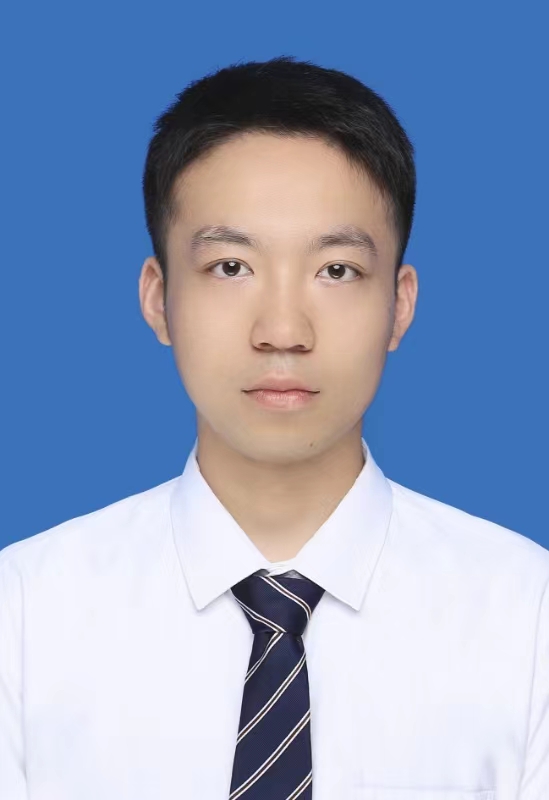
刘启亮,山东龙口人,博士,教授(破格晋升),硕/博士生导师,入选国家“四青人才”(教育部“青年长江学者”)。主要研究方向:多尺度时空统计与数据挖掘理论与方法及其在地球深部制图、智慧城市中的应用。先后主持国家自然科学基金(面上2项、青年1项)、国防科技基础加强计划领域基金项目、国家重点研发计划专题(2项)、湖南省自然科学基金(重点、优青、面上、青年)等国家级与省级科研项目10余项。曾获得中南大学“升华猎英计划”、“创新驱动计划”(结题优秀)资助,近年来以第一/通讯作者在国际地理信息、地学计算顶级刊物International Journal of Geographical Information Science、Geographical Analysis等发表SCI/SSCI期刊论文40余篇;在中国科学(信息科学)、测绘学报等中文权威刊物发表学术论文20余篇,出版学术专著与教材4部。以主要完成人获得教育部自然科学二等奖、科技进步二等奖,自然资源部科技进步一等奖,中国地理信息科技进步特等奖、一等奖以及中国测绘科技进步二等奖。
学术兼职:
[5] 中国测绘学会智能化测绘专业委员副秘书长
[4] 中国GIS协会理论与方法工作委员会委员
[3] 中国测绘学会矿山测量专业委员会委员
[2] 学术期刊服务:
《测绘学报(英文版)》编委
《时空信息学报》青年编委
国内外地理信息、地学数据挖掘权威期刊审稿人:International Journal of Geographical Information Science、Geology、IEEE Transactions on Knowledge and Data Engineering、IEEE Transactions on Industrial Informatics、Knowledge-based Systems、Applied Soft Computing、Geographical Analysis、Computers, Environment and Urban Systems、 Cartographic and Geographical Information Science、Computers&Geosciences、Transactions in GIS 及《测绘学报》、《计算机研究与发展》、《电子学报》等
[1] 学术会议服务:
The 20th Pacific Asia Conference on Information System专辑编辑
IEEE International Conference on Big Data Analysis专业委员会委员
讲授课程:地理信息系统原理与应用(本科生)、空间分析(本科生)、空间统计基础(本科生)、空间数据挖掘(本科生);时空大数据挖掘技术(硕士/博士)、科技论文写作(硕士/博士)、测绘遥感工程应用(博士)
招生方向:时空统计、时空数据挖掘、地理信息创新软件研发(2026年已招收快速响应博士生,不再招收普通批次)
招生专业:地理信息科学、测绘工程、遥感科学与技术、资源勘查工程、地球物理学、统计学、计算机科学及其他相关专业
1. 重视理论分析和实际应用能力的提高,尤其是应用数学和GIS工具分析和解决地学问题的能力;
2. 培养具有扎实地学基础和坚实地理信息空间分析技术的研究与应用型人才;
3. 培养地学、数学、信息科学交叉型复合人才;
4. 为学生提供国内外学术交流的平台,拓宽国际视野。
欢迎具有时空统计/数据挖掘研究兴趣、扎实地理信息软件开发技能的同学报考硕士/博士研究生,常年招收青年学者开展博士后科研合作!
地学统计研究小组具体信息见公众号:

科研奖励:
6. 刘启亮 (3/15), 城市时空信息精细感知与智能挖掘关键技术及应用,自然资源科学技术将一等奖,2025.
5. 刘启亮 (5/15), 城市时空大数据聚合表达与挖掘关键技术及应用,中国地理信息科技进步奖特等奖,2023.
4. 刘启亮 (5/10), 城乡规划业务全生命周期智能化管理平台建设与应用,教育部科技进步二等奖,2016.
3. 刘启亮 (2/10),地理空间数据挖掘的理论、方法及应用,中国测绘科技进步二等奖,2014.
2. 刘启亮 (3/5),地理空间关系建模的理论与方法,教育部自然科学奖二等奖,2014.
1. 刘启亮 (4/12),多源多尺度空间数据不一致性探测处理的理论与方法,中国地理信息科技进步奖一等奖,2013.
教材与专著:
4. 邓敏, 刘启亮, 石岩, 唐建波. 2021. 空间分析(第二版). 北京:测绘出版社
3. 邓敏, 樊子德, 刘启亮. 2016. 空间分析实验教程. 北京:测绘出版社
2. 邓敏, 刘启亮, 吴静. 2015. 空间分析. 北京:测绘出版社
1. 邓敏, 刘启亮, 李光强, 黄健柏. 2011. 空间聚类分析及应用. 北京:科学出版社
代表性工作:
中文论文:
7. 刘启亮,陈玉铉,刘占坤,毛先成,邓敏. 2026. 金属矿山深部断层三维结构重建的深度卡尔曼滤波法:以胶东半岛夏甸金矿为例. 地球科学, 接受待刊.
6. 刘启亮,阳洁,毛先成,刘占坤,邓敏. 2025. 空间数据插值的杨赤中滤波与推估法. 测绘学报, 54(8): 1501-1517.
5. 阳洁, 刘启亮(通讯作者), 冯天琪, 邓敏. 2023. 时空数据插值的杨赤中滤波法. 测绘学报, 52(10): 1760-1771.
4. 李志林, 刘启亮(通讯作者), 唐建波. 2017. 尺度驱动的空间聚类理论. 测绘学报, 46(10): 1534-1548.
3. 邓敏, 刘启亮, 王佳璆, 石岩. 2012. 时空聚类分析的普适性方法. 中国科学(信息科学), 42(1): 111-124.
2. 刘启亮, 邓敏, 王佳璆, 彭思岭, 赵玲, 梅小明. 2011. 时空一体化框架下时空异常探测. 遥感学报, 15(3): 457-474.
1. 刘启亮, 邓敏, 石岩, 彭东亮. 2011. 一种基于多约束的空间聚类方法. 测绘学报, 40(4): 509-516.
英文论文:
19. Chen M H, Liu QL(corresponding author), Yang J, Lu Z X, Deng M. 2025. A density-based method for community detection in bilayer mobility networks. International Journal of Geographical Information Science, DOI:10.1080/13658816.2025.2548818(中科院一区TOP期刊).
18. Yang J, Liu QL(corresponding author), Mao XC, Liu ZK, Deng M. 2025. YangNet: a nonlinear and nonstationary spatial interpolation method based on spatial compound variable theory. International Journal of Geographical Information Science, DOI:10.1080/13658816.2025.2508840(中科院一区TOP期刊).
17. Liu QL, Wu GS, Liu ZK, Mao XC, Yang J, Deng M. 2024. Local phase-constrained convolutional autoencoder network for identifying multivariate geochemical anomalies. Computers & Geosciences, DOI:10.1016/j.cageo.2024.105679(JCR一区、中科院二区期刊).
16. Chen YX, Liu QL(corresponding author), Yang J, Cheng XH, Deng M. 2024. Spatially constrained statistical approach for determining the optimal number of regions in regionalization. International Journal of Geographical Information Science, DOI:10.1080/13658816.2024.2372779(中科院一区TOP期刊).
15. Yang J, Liu QL(corresponding author), Mao XC, Liu ZK, Zhu YC, Deng M. 2024. Generalized Yang Chizhong filtering and interpolation method without stationarity assumption. International Journal of Geographical Information Science, DOI:10.1080/13658816.2024.2344186(中科院一区TOP期刊).
14. Liu QL, Li YZ, Yang J, Deng M, Li JJ, An KY. 2024. Physics-guided spatio–temporal neural network for predicting dissolved oxygen concentration in rivers. International Journal of Geographical Information Science, DOI: 10.1080/13658816.2024.2342321(中科院一区TOP期刊).
13. Liu QL, Zhu YC, Yang J, Mao XC, Deng M. 2023. CoYangCZ: a new spatial interpolation method for nonstationary multivariate spatial processes. International Journal of Geographical Information Science, DOI: 10.1080/13658816.2023.2268665(中科院一区TOP期刊).
12. Yang J, Liu QL(corresponding author), Deng M. 2023. Spatial hotspot detection in the presence of global spatial autocorrelation. International Journal of Geographical Information Science, DOI: 10.1080/13658816.2023.2219288(中科院一区TOP期刊).
11. Liu QL, Yang J, Mao XC, Liu ZK, Deng M, Chen YX, Liu WK. 2023. Identifying geochemical anomalies using a new method of Yang Chizhong-spatial scan statistic. Computers & Geosciences, DOI:10.1016/j.cageo.2023.105392(JCR一区、中科院二区期刊).
10. Liu WK, Liu QL(corresponding author), Yang J, Deng M. 2022. A network-constrained clustering method for bivariate origin-destination movement data. International Journal of Geographical Information Science, DOI: 10.1080/13658816.2022.2137879(中科院一区TOP期刊).
9. Liu QL, Yang J, Deng M, Liu WK, Xu R. 2022. BiFlowAMOEBA for the identification of arbitrarily shaped clusters in bivariate flow data. International Journal of Geographical Information Science, DOI: 10.1080/13658816.2022.2072850(中科院一区TOP期刊).
8. Liu WK, Liu QL(corresponding author), Deng M, Cai JN, Yang J. 2021. Discovery of statistically significant regional co-location patterns on urban road networks. International Journal of Geographical Information Science, DOI:10.1080/13658816.2021.1981335(中科院一区TOP期刊).
7. Liu QL, Yang J, Deng M, Song C, Liu WK. 2021. SNN_flow: a shared nearest-neighbor-based clustering method for inhomogeneous origin-destination flows. International Journal of Geographical Information Science, DOI:10.1080/13658816.2021.1899184(中科院一区TOP期刊).
6. Liu QL, Liu WK, Deng M, Cai JN, Liu YL. 2021. An adaptive detection of multilevel co-location patterns based on natural neighborhoods. International Journal of Geographical Information Science, 35(3): 556-581(中科院一区TOP期刊).
5. Liu QL, Wu ZH, Deng M, Liu WK, Liu YL. 2020. Network-constrained bivariate clustering method for detecting urban black holes and volcanoes.International Journal of Geographical Information Science, 34(10):1903-1929(中科院一区TOP期刊).
4. Liu QL, Liu WK, Tang JB, Deng M, Liu YL. 2019. Two-stage permutation tests for determining homogeneity within a spatial cluster. International Journal of Geographical Information Science, 33(9):1718-1738(中科院一区TOP期刊).
3. Deng M, Cai JN, Liu QL(corresponding author), He ZJ, Tang JB. 2017. Multi-level method for discovery of regional co-location patterns.International Journal of Geographical Information Science, 31(9): 1849-1870(中科院一区TOP期刊).
2. Liu QL, Zhu SC, Deng M, Liu WK, Wu ZH. 2020. A spatial scan statistic to detect spatial communities of vehicle movements on urban road networks. Geographical Analysis, DOI:10.1111/gean.12278(JCR一区期刊).
1. Cai JN, Deng M., Liu QL(corresponding author), He ZJ, Tang JB, Yang XX. 2019. Nonparametric significance test for discovery of network-constrained spatial co-Location patterns. Geographical Analysis, 51(1): 3-22(JCR一区期刊).
其他英文论文:
18. Liu QL, Huang YQ, Yang J, Li Junjie, Wu Yueda, Zhou Xiaoran. 2025. Spatial interpolation in the presence of spatial stratified heterogeneity: stratified kriging or ordinary kriging? Transactions in GIS. DOI:10.1111/tgis.70180(JCR一区期刊).
17. Liu QL, Wei ZK, Yang J, Deng M. 2025. Flow Yang Chizhong filtering for correcting global spatial autocorrelation in flow hotspot detection. Transactions in GIS, 29(1): e13278(JCR一区期刊).
16. Liu QL, Lu ZX, Huan WH, Fan C. 2024. Adaptive weighted multi-view subspace clustering method for recognizing urban functions from multi-source social sensing data. Geo-spatial Information Science. DOI: 10.1080/10095020.2024.2356243(JCR一区、中科院二区期刊).
15. Liu QL, Huan WH,Deng M, Zheng XL, Yuan HT. 2021. Inferring urban land use from multi-source urban mobility data using latent multi-view subspace clustering. ISPRS International Journal of Geo-Information, 10(5), 274(JCR二区期刊).
14. Liu QL, Liu WK,Tang JB, Deng M, Liu YL. 2019. Permutation-test-based clustering method for detection of dynamic patterns in spatio-temporal datasets. Computers, Environment and Urban Systems, 2019,75:204-216(中科院一区TOP期刊).
13. Cai JN, Liu QL(corresponding author), Deng M, Tang JB, He ZJ. 2018. Adaptive detection of statistically significant regional spatial co-location patterns. Computers, Environment and Urban Systems, 68:53-63(中科院一区TOP期刊).
12. Li ZL, Liu QL(corresponding author), Tang JB, Deng M. 2018.An adaptive method for clustering of spatio-temporal events.Transactions in GIS,22(1):323-347(JCR一区期刊).
11. Deng M, Yang WT, Liu QL(corresponding author), Jin R, Xu F, Zhang YF. 2018. Heterogeneous space–time artificial neural networks for space–time series prediction. Transactions in GIS, 22(1):183-201(JCR一区期刊).
10. Deng M, Tang JB, Liu QL(corresponding author), Wu F. 2018. Recognizing building groups for generalization: a comparative study. Cartography and Geographic Information Science, 45(3): 187-204(JCR一区、中科院二区期刊).
9. Deng M, He ZJ, Liu QL(corresponding author),Cai JN, Tang JB. 2017. Multi-scale approach to mining significant spatial co-location patterns. Transactions in GIS, 22(5):1023-1039(JCR一区期刊).
8. Deng M, Fan ZD, Liu QL(corresponding author), Gong JY. 2016. A hybrid method for interpolating missing data in heterogeneous spatio-temporal datasets. ISPRS International Journal of Geo-Information, 3(13)(JCR二区期刊).
7. Liu QL, Li ZL, Deng M. 2015. Modeling the effect of scale on clustering of spatial points. Computers, Environment and Urban Systems, 2015,52:81-92(中科院一区TOP期刊).
6. Liu QL, Tang JB, Deng M, Shi Y. 2015. An iterative detection and removal method for detecting spatial clusters of different densities. Transactions in GIS, 19(1):82-106(JCR一区期刊).
5. Liu QL, Deng M, Bi JT, Yang WT. 2014. A novel method for discovering spatio-temporal clusters of different sizes, shapes, and densities in the presence of noise. International Journal of Digital Earth, 2014,7(2):138-157(JCR一区、中科院二区期刊).
4. Deng M, Liu QL, Wang JQ. 2013. A general method of spatio-temporal clustering analysis. Science China Information Sciences,56:1-14(中科院一区TOP期刊).
3. Liu QL, Deng M, Shi Y. 2013. Adaptive spatial clustering in presence of obstacles and facilitators. Computers & Geosciences, 56: 104-118(JCR一区、中科院二区期刊).
2. Liu QL, Deng M, Wang JQ, Shi Y. 2012. A density-based spatial clustering algorithm considering both spatial proximity and attribute similarity. Computers & Geosciences, 46: 296-309(JCR一区、中科院二区期刊).
1. Deng M, Liu QL, Cheng T, Shi Y. 2011. An adaptive spatial clustering algorithm based on Delaunay triangulation. Computers, Environment and Urban Systems, 35:320-332(中科院一区TOP期刊).
教育经历
[1] 2011.9-2014.9
香港理工大学
|
地理信息系统
|
哲学博士
|
博士研究生毕业
博士论文:Scale-driven clustering of geographic point data
[2] 2008.9-2011.6
中南大学
|
大地测量学与测量工程
|
硕士学位
|
硕士研究生毕业
硕士论文:自适应空间聚类方法研究(湖南省优秀硕士学位论文)
[3] 2004.9-2008.6
中南大学
|
信息物理工程/测绘工程
|
学士学位
|
大学本科毕业
学士学位论文:三个目标间空间关系计算模型(中南大学优秀学士学位论文)
团队成员
团队名称:地学统计(Geostatistics)
团队介绍:以时空自相关建模、时空聚类分析为主要研究内容,探索地学现象的时空分布规律,服务智慧城市、矿产资源勘查国家重大需求。
| 阳洁 | |
安徽安庆人,2019年本科毕业于中南大学测绘工程专业,2020级地图制图学与地理信息工程专业博士(硕博连读),2024年12月获得博士学位,赴香港理工大学从事博士后研究。主要研究方向:杨赤中滤波与推估、矿化三维建模,就读期间发表JCR1区论文9篇(其中在国际地理信息顶级刊物International Journal of Geographical Information Science发表论文7篇),国内测绘地理信息权威刊物《测绘学报》论文2篇,先后获得国家奖学金、中南大学校长奖学金及其他校级奖励金4次。 |
| 刘文凯 | |
山东淄博人,地图制图学与地理信息工程2018级博士研究生,2022年6月获得工学博士学位,现任职华南师范大学,特聘研究员。主要研究方向:城市地理大数据关联模式挖掘。就读期间在地理信息国际顶级刊物International Journal of Geographical Information Science发表学术论文4篇,城市地理学权威刊物Computers, Environment and Urban Systems发表学术论文1篇,国内测绘地理信息权威刊物《测绘学报》发表论文1篇,主持中南大学研究生创新课题1项(已结题),在国际学术会议做口头报告一次(GeoInformation2019,澳大利亚悉尼),多次获得国家奖学金、校级奖励金,博士论文获全国高校GIS论坛“优秀博士学位论文”。 |
| 朱永川 | |
甘肃省武威人,2022年毕业于中南大学,2025年获得中南大学学术硕士学位(免试推荐),现工作于广州市城市规划勘测设计研究院。主要研究方向:多元杨赤中滤波与推估法。就读期间在国际地理信息顶级刊物International Journal of Geographical Information Science发表学术论文1篇,获得研究生国家奖学金1次,研究生一等学业奖学金3次,研究生数学建模竞赛全国二等奖。 |
| 魏子凯 | |
湖北省武汉市人,2022年毕业于湖南科技大学,2025年获得中南大学工学硕士学位,现工作于华为技术有限公司。主要研究方向:地理流数据挖掘与软件研发。就读期间在国际地理信息权威刊物Transactions in GIS发表SSCI论文1篇,申请软件著作权2项,参与申请国家发明专利1项,获得研究生数学建模竞赛二等奖。 |
| 黎煜昭 | |
江西省上饶市人,2019年毕业于长沙理工大学测绘工程专业,2023年获得中南大学工学硕士学位,现工作于广州市城市规划勘测设计研究院。主要研究方向:数据与知识协同的时空智能预测方法及其在水质预测中的应用。就读期间在国际地理信息顶级刊物International Journal of Geographical Information Science发表学术论文1篇、地球信息科学学报发表论文1篇。 |
| 侯昭怡 | |
湖南省郴州市人,2020年毕业于中国石油大学(华东),2023年获得中南大学工学硕士学位,现工作于比亚迪股份有限公司。主要研究方向:城市空间社团检测。就读期间发表JCR1区SCI论文1篇,获得研究生优秀奖学金1次。 |
| 郇卫华 | |
河南焦作人,2019年本科毕业于河南理工大学数学与应用数学专业,同年保送就读于中南大学地图制图学与地理信息工程硕士专业,2022年6月获得工学硕士学位,现博士就读于同济大学。主要研究方向:城市多源交通流多视角聚类,发表SCI论文2篇,曾获中南大学测绘学科研究生优秀学术报告“一等奖”,多次获得优秀学生、优秀研究生奖学金等荣誉。 |
| 朱三成 | |
重庆人,2018年本科毕业于中南大学地理信息科学专业,同年保送就读于中南大学地图制图学与地理信息工程专业,2021年硕士毕业。主要研究方向:空间社团结构统计挖掘。就读期间发表SCI论文2篇(其中国际空间分析顶级刊物Geographical Analysis1篇),申请并授权国家发明专利1项,在国际会议(GeoComputation2019,新西兰皇后镇)做口头报告一次。 |
| 吴智慧 | |
河南商丘人,2017年本科毕业于中南大学地理信息科学专业,同年就读于中南大学地图制图学与地理信息工程专业,2020年硕士毕业,现工作于广州市城市规划勘测设计研究院。主要研究方向:城市交通流异常模式挖掘。就读期间在国际地理信息顶级刊物International Journal of Geographical Information Science发表学术论文1篇,申请并授权国家发明专利1项,主持中南大学研究生创新课题1项(已结题), 在国际会议(GeoComputation2019,新西兰皇后镇)做口头报告一次。 |


